Crossed the Ninth Street bridge into downtown and rode the Strip District Trail to the Point, then across the Ft. Pitt bridge to Station Square. At the upper end of Riverfront Park I was pleased to see that the curbcut for the transition from the trail to the roadway has been restored.
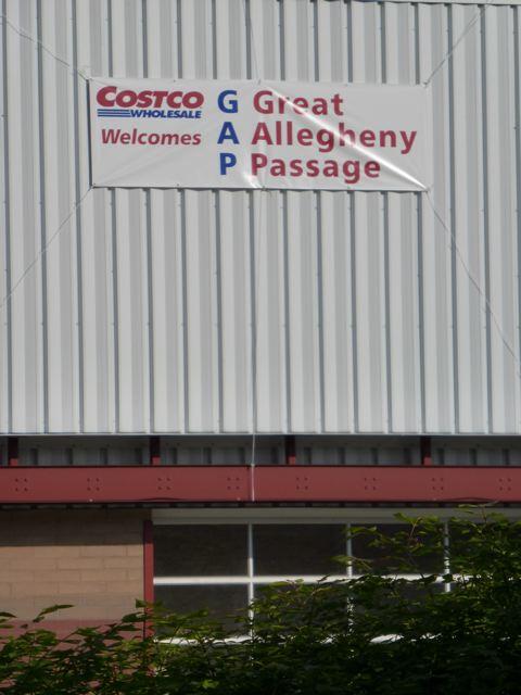
Rode around to Keystone Metals and Sandcastle, and it was nice to be out there so early - you could see it was going to be a hot day. Saw this sign hanging on the CostCo building:

I think that's a nice touch, especially since I bet all the bicyclists could be seen as kind of a nuisance to CostCo - using the parking lot, scrounging the rest rooms, presenting hazards at the stop signs, etc. +1 Costco.
Reversed course and took the Hot Metal Bridge to the Jail Trail. At Grant Street, took the shared sidewalk to Smithfield Street and that's where we saw Lynn, a cyclist our own age looking a bit flummoxed at choosing a route.
Originally from Australia, Lynn has lived in the area for the last 35 years. She lives in Homestead and is a regular cyclist and trail user. Excited about the new Sandcastle trail, she's ridden up to the Hot Metal Bridge. She continued along the river and crossed the Smithfield Street Bridge. Now she's at Smithfield Street and totally at a loss about identifying a safe route to ride to Point State Park without a lot of car traffic.
We introduced ourselves and escorted her along First Avenue. For her ride back, we pointed out the ramp for the Ft. Pitt bridge to the Station Square trail. When local residents ride to Smithfield Street and don't find wayfinding support to get to Point State Park, it demonstrates a lack of design, signage and support.
It's inhospitable to entice people into a location and not make it easy to navigate. It's bad business to make visiting the city a frustrating experience; they won't come back. We want the early adopters to become evangelists, not mine-canaries. Could we have a little help?
and then, speaking of a little help: Rode the Bastille Trail to the trailhead, and saw a dozen volunteers cutting back the foliage which was growing along the trail. Enough to restore your faith in humanity. Thanks to everybody who came out!
If you ride up from the EF Trail, there's a little green sign that points you across Smithfield, where you're forced either to turn left, across the bridge, or right, across Ft Pitt BV. When you cross Ft Pitt, there's another sign pointing left towards town.
ReplyDeleteWhoever thought Ft Pitt was a good road to ride on has never tried it. Last time I did, I bailed after a block and took the parking ramp down to the Mon Wharf, which (after a fashion) connects with the trail into Point SP. However, you have to either take a hard right immediately at the bottom of the ramp and traverse some truly awful pavement, or go all the way down to the riverwalk and navigate through folks fishing and hanging out, then jump a sizable curb, to get to the path up to PSP--which is probably not wide enough to admit even a small wheelchair, and is only barely bikeable.
Actually I spoke to someone at Costco and they're planning Bike racks! I had a lost traveller as well. A frenchman "lost in a loop" in McKeesport. He had come up the Yough trail, got to McKeesport and couldn't figure out the signage. Wanted to ride to the point but couldn't find the trail! I got him on course. I agree with you it's rude to lead strangers into a place and loose them with poor directions. What can WE do?
ReplyDelete