Type 2 Diabetic. Cyclist Flâneur.   Coffeeneur.    Errandoneur
A bike / map geek with a gadget obsession and a high-viz fetish.
Showing posts with label bike nap. Show all posts

Saturday, August 31, 2013

SQL double entendre, Betty Foy Rivendell Mixte, and it's San Andreas' Fault

8/31/2013 43m
Today's ride was brought to me by the remarkable regional bike map makers of KrebsCycleProducts.com. Three words: awesome. thank you. The map I bought from a LBS shows good bike roads, trails, classification of steep hills, and all sorts of local info embedded in the map. Really sweet.

This was my second day with the Rivendell Betty Foy mixte and I really like this bike. Primarily, I love the mount/dismount of the mixte. The frame geometry is excellent, very comfortable. I love the handlebars which are much bigger than what I have on my bike (these are just a teeny bit bigger than my shoulders) and they really open up the chest and it's a great ride. There's more in the details of what I like about the Betty Foy, but more on that later.

The first leg was Redwood City via SQL to SFO. SQL is the three-letter airport identifier for the Santa Clara Airport, and of course it's also a geek code acronym for Structured Query Language so in this part of the world that's like hipster-ironic.

You might think, Nah that's not ironic. But today when the bike trail wound through the Oracle campus, I saw that the signs warning you of an approaching pedestrian crosswalk looked like this - so I'm thinking, woah, SQL.(airport/acronym) = geek double entendre.


This leg of the ride was along the west shore of San Francisco Bay. A lot of bike trails, some road riding, with the wind definitively out of the north.


This is the obligatory multi-modal retired-air-traffic-controller photo of SQL Tower.


Conditions on this ride were warm and the environment was marine-estuary-littoral. Boats and marinas (and airplanes) and really nice parks interrupted by really pragmatic warehouses and the standard waterfront buildings, including the local women's prison which I kind of got lost at and that was a funny place to be asking directions dressed like a cyclist.


This was a bike trail bridge that I passed later on, I haven't seen one of these before:


Ended up across a marsh from the San Francisco Airport, where it seems like they're building a new ATC Tower, pretty close to the existing one. (If you're keeping score, this is my second bike-tower pic of the day).


Stopped and took a brief bike-nap while 747s and such were landing. That was pretty cool. #BikeNap

Decided to take a different way back. What I meant to do was to go inland, climb to the top of the ridgeline, and then ride on Canada Road (which had been recommended to me, and they pronounce it Can-yada here).


They have hills here. When they name streets "Hillcrest", they know what they're doing. That was an arduous climb, and I really missed my 20-tooth granny on my LHT's triple-chainring (the Betty Foy I'm riding has a double chainring). This is how steep it was: the front wheel came off the road three times. I wanted to cry but it was so pretty I just couldn't.

So I climbed up to the top of the ridgeline, and after doing my beached-whale imitation and gasping for breath I started riding on a trail that parallels the ridge. The trail runs along San Andreas Lake, and there's a marker identifying the San Andreas Fault that's underneath. They calculate that during the great SF earthquake, the position of the fault moved 9 feet west relative to the rest of the planet.


The ride up on top of the ridge was in a completely different environment from the ride down at the bay. A local rider told me that San Franciscans consider that they live in "microclimates" and that there are, for instance, huge temperature variations from one side of town to the other, or from the ocean side to the bay side. This place was deep blue water (looked cold), big dark green trees, and very rugged hills. No airplanes, cars, or anything with an engine in sight.

Although I planned to ride along the ridgeline for quite a while, a bridge was out. The puboished detour was to ride down to pretty much the bottom, ride south, and then ride back up to the top. Once I pointed the bike downhill there was no way I was going to ride back up that hill; I'm saving that treat for another day.

Finally, on the way home through the business districts of several towns I stopped at Nikkos Mexican Grill, which was excellent.


I've long held that "any day you can see the water is a good day", and today I got to see the SF Bay, the San Andreas Lake, and also the Crystal Springs Reservoir. I got to see two Towers and also a new one in the making, and I got to eat really good food on a bright sunny day. #LivingTheDream.


Thursday, July 12, 2012

Bride of Penn Avenue, Destiny of Sand Sculptures, Risk of Bike Naps

07/12/12 #241 70m
Two rides today, one 45 miles and the other 25 miles.

Started in the morning at the Bastille, rode south into Point State Park where against all expectations the sandy mess of the previous day, the debris of the remarkable artwork of the previous week, had somehow not been cleared away but had instead become more organized into a pile, somehow resisting the famous forces of entropy.


Rode south on the Station Square Trail, Waterfront Trail, Kennywood Trail, to the Riverton Bridge. Reversed and rode north to the Hot Metal Bridge, Junction Hollow Trail, Fifth, Wilkins, Murray, and Forbes. Poked around at PghProBikes.

Departed Squill crosstown in search of the mural, The Bride of Penn Avenue, by Judy Penzer and Jill Watson. Coming within a few blocks of it, you can see the mural of a bride entering the building.


When you get closer, you can discern that the apparent building is a mirage painted upon a flat wall. The visual continuation of the row of buildings is a head-fake. Very impressive.


Tragically, the two artists died in the crash of TWA800 on July 17th, 1996.

Rode Penn Avenue to 24th Street and the Cork Factory, the Convention Center Trail to the Point once again, where the irresistable forces of PeopleWhoWantFridayOff eventually overcame Inertia and both the wreckage and the sand sculpture itself was just a memory.


Rode north to the Bastille and my car for 45 miles on the bike so far. Moved my car to Oakland for the afternoon's logistics, then proceeded to take a well-deserved bike nap. Taking a bike nap is not without risk; well-meaning passersby may assume you have passed out or entered a diabetic coma. Word: if you're bikenapping and wake up to the sound of somebody saying "CLEAR" in an authoritative voice, shout out NO! NO! NO!


Rode around town some more, then rode through the South Side Works River Front Plaza, which is almost too many words in one placename; saw that the cooling mist generators (CMGs) were active.


Rode to West Mifflin for a friend's celebration. 837/885 up the hill was a great workout; coming back down was a lot more fun. The day's second ride was 25 miles, for 70 miles total.

Friday, May 18, 2012

PhotoBomb B2W-PGH, Bike Nap Cecil, Farmhouse Coffee

05/18/12 243# 50m
Rode 22 miles with S in the morning, 28 miles with R in the afternoon, 50 miles total on Bike To Work Day

Started at 0700 at the Bastille, cool enough for a sweater. Stopped at a "bike to work" support station by the stadium supported by The Priory, two very cool dogs there and some very nice bikes, excellent swag (wool socks, water bottle!) Rode around the Point, took the Strip District Trail, arrived at the City-County building in time for the 0830 presser.

Saw some great bicycles there including a Trek1100 just like my road bike, and a Trek830 just like my trail bike, representing old school. I was very pleased to see (and get to use) the demonstration bus bike rack (and thanks to Steve Patchan for the briefing).


Also spoke with a PAT expert who made a few more points: if you're the first bike using the rack, use the slot close to the bus; put the spring-loaded clip as high as possible; consider putting a pre-paid bus card in your bike bag, so if you ride in to the city in the morning and get surprised by rain, you could just take out your card and take the bus home. (I thought that was a great multi-modal point.)

The 0830 event got underway about 0900 when Hizzoner the Mayor arrived to work on a bike along with Scott Bricker (BikePgh), Bruce Woods (PMTCC), and a few other worthies I didn't recognize.


Behind the County Executive (the grownup in the suit) there's a very attractive Surly LHT with a two-legged kickstand, an orange triangle, and Ambridge Bike Shop water bottles. Just saying: photobomb ftw!

Back on the bike, Jail Trail, Hot Metal Bridge, Keystone Metals, REI for the Anniversary Sale. Bought new bike shoes at 20% off. Station Square, Ft. Pitt and Ft. Duquesne bridges, Bastille: 22 miles on a beautiful morning.

Drove out to the west and took a mini bike-nap on the Montour Trail near Cecil and MP23, then my friend R came by and woke me. We rode southwest past the Twin Bridge construction, walking up to the trail at Georgetown, then rode to world-famous Farmhouse Coffee for Farmhouse espresso, iced tea, and red velvet biscotti.

Once fortified we continued (east, I think) past the new Bebout Bridge to Logan Road. I don't get out on this section of the trail much, trail conditions were excellent.

Reversed and returned, stopped for a few minutes above the creek at the golf course. My total mileage for the day was 50.

Thursday, March 15, 2012

Fracking and Napping the Ides of March

03/15/12 #238 33m 2h38m


Rode the Montour Trail, starting at Enlow and riding southwest. I haven't been out this way in a while, and the nascent Marcellus Shale footprint has really changed the local landscape.

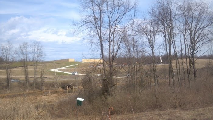
There's the fracking fluid remediation facility in Boggs, which sits on top of a series of abandoned mines. There's the trail reconstruction to accommodate a fracking-fluid railway between MP19 and MP21, a major bit of earth-sculpting. At the road crossings there's a lot of shale vehicles and equipment, and at MP16 there's this sight of blue skies, birdhouses, and resource retrieval:


They really do make an effort to be sub-overt.

After Route50 the trail resumed its normal path, and somewhere around MP23-ish I found a favorite grassy spot under a tree and indulged in a bike nap. (See related flickr group)

I had a very nice nap of about a half-hour, just enough time for some major whack dreaming and some serious snoring, then I woke up feeling quite sprightly and enjoyed the ride back to the start all the more. I think napping along the trail is something that senior citizens can get away with, and I'm going to start embracing my Inner Geezer on days like this.

Today's snack experiment was an Odwalla White Chocolate, Macadamia Nut Bar, totally excellent. There's not any water available along this segment of the trail, and the soda machine at the Rt.50 skin cancer dispensary tanning salon was sold out, so the bottles were dry by the time I was done.